Water under your feet
Push a spade into a beach and the bottom of the hole soon fills with water. Wells work the same way on a larger scale. Below a certain depth the ground is wet everywhere, not because there is a lake down there but because the tiny gaps between grains of sand and gravel are full of water. That water is groundwater. Leave aside the ice caps and glaciers, and almost all the world’s fresh water is groundwater: roughly a hundred times as much as in all the lakes and rivers together.
A layer of rock or sediment that holds groundwater and lets it flow out readily is an aquifer. Sand and gravel make good aquifers, as do sandstone and cracked limestone. Clay holds plenty of water too, but its pores are so fine that water barely moves through it, so a clay layer acts as a floor or a lid.
The water table
Above the aquifer is ground whose pores hold both air and water. Go deeper and the air runs out: every gap is filled. The boundary between the two is the water table. In a well, the water stands at the level of the water table around it.
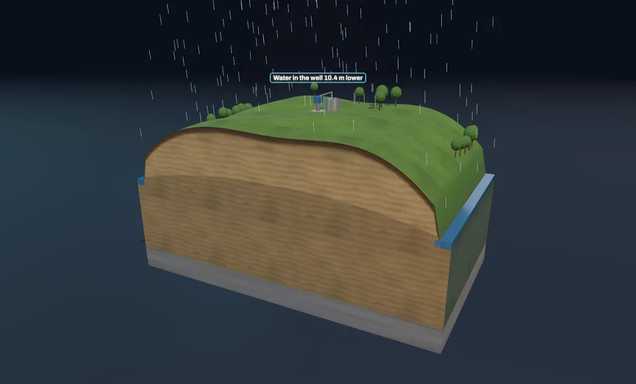
The water table is not flat. Rain soaks in and adds water from above, while the water drains sideways towards streams, lakes and the sea, where the water table meets the surface. The result is a gentle bulge between streams that follows the shape of the land, only flatter. More rain makes the bulge higher; a drought lets it sink back towards the level of the streams. That is why many streams keep flowing for weeks without rain: groundwater seeps into them through their beds.
Try it: set Pumping rate to 0 and choose Water table under Cut into the ground. Then move Rainfall from 100 to 1600 mm per year and watch the blue surface rise between the streams.
How water moves through sand
Groundwater flows from where the water table is high to where it is low, pushed by the difference in height. In the 1850s the French engineer Henry Darcy, designing sand filters for the fountains of Dijon, found that the flow is proportional to that slope and to how easily the material lets water through, its hydraulic conductivity. In fine sand like the block in the Scene, groundwater typically creeps a few centimetres to a few tens of centimetres a day. Through gravel it can be a hundred times faster; through clay, ten thousand times slower or more. Water that falls as rain in the middle of a large aquifer can spend years, or even thousands of years, underground before it reaches a stream.
The cone of depression
A pump lowers the water inside a well. Water then flows into the well from all around, which needs a slope, so the water table dips towards the well in a funnel called the cone of depression. It is steepest right next to the well, where all the water crowds through a small space, and flattens out with distance. The faster the pumping, the deeper and wider the cone.
Try it: slide Pumping rate up to 400 m³ per day, then to 800. With too much pumping the water inside the well falls to the pump, and the well can only deliver part of what is asked. Now try 800 m³ per day with Rainfall down at 100 mm per year.
The water a well pumps is not new. Once the cone has settled, every litre is water that used to reach the streams. Pump hard enough during a dry spell and the slope near a stream reverses: the stream starts leaking into the ground towards the well. Neighbouring wells share the same water too: when their cones overlap, each lowers the water in the others.
When more is taken than falls
If wells take out more water each year than rain puts back, the water table keeps falling. Wells must be deepened, streams and wetlands dry up, and near the coast salty seawater can creep inland into the aquifer. In some places the ground itself sinks as the emptied clay layers compact; parts of California’s Central Valley and Mexico City have sunk by several metres this way. Many deep aquifers were filled thousands of years ago in a wetter climate, so water pumped from them is effectively mined.
What this model leaves out
The Scene shows a steady state: the water table that a rate of rain and pumping would settle to after years. Real aquifers respond slowly, and rain comes in seasons rather than as a steady trickle. The sand is uniform, the clay floor is flat and perfectly watertight, and only one aquifer is shown; real ground has layers of different conductivity, and a confined aquifer trapped under clay is under pressure, so water in a well drilled into it rises above the top of the aquifer. The share of rain that reaches the water table is fixed at a quarter, while in reality it depends on the soil, the plants and how heavily it rains.