A world of ice and thaw
Twenty thousand years ago, ice sheets up to three kilometres thick covered most of Canada and northern Europe. So much water was locked up on land that the sea stood about 120 metres lower than today, and you could walk from Siberia to Alaska. Then, within about ten thousand years, most of that ice melted.
That was only the latest of many ice ages. Bubbles of ancient air and layers of snow in Antarctic ice cores, and the shells of tiny sea creatures in ocean mud, record the last 800,000 years in detail. They show long cold spells, each about 100,000 years, broken by short warm ones, the interglacials, which last ten to thirty thousand years. We live in one now. Something kept the beat.
Three slow cycles
In the early twentieth century the Serbian engineer Milutin Milankovitch spent decades calculating, by hand, how the pull of the other planets slowly changes Earth’s orbit and spin. Three changes matter.
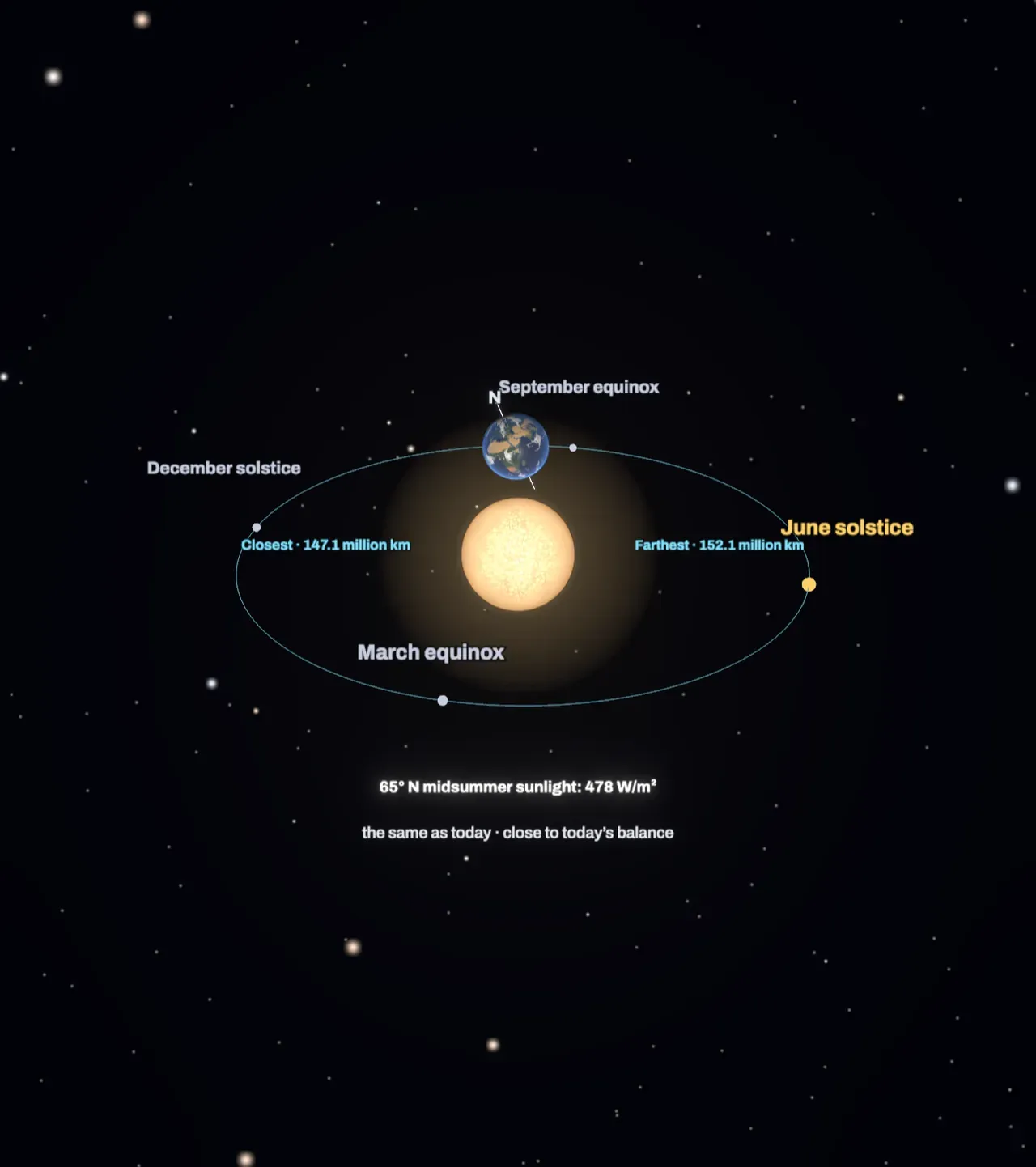
- Eccentricity is how oval the orbit is. It drifts between almost a circle and an eccentricity of about 0.06, over cycles of about 100,000 and 405,000 years. Today it is 0.0167: the Earth is about 147 million kilometres from the Sun in early January and 152 million in early July.
- Axial tilt swings between about 22.1 and 24.5 degrees and back every 41,000 years. Today it is 23.44 degrees and slowly falling.
- Precession is the slow wobble of the spinning Earth’s axis, like a top’s, combined with the slow turning of the orbit itself. Together they move the point where the Earth passes closest to the Sun, called perihelion, all the way round the calendar every 19,000 to 24,000 years. Today the Earth is closest in early January; about 11,000 years ago it was closest in northern summer.
Why northern summers matter
None of these changes alters the total sunlight the Earth receives over a year by more than about a fifth of a per cent. What they change is how it is shared out between the seasons and between high and low latitudes.
Milankovitch’s key idea was that ice sheets do not grow because winters are cold. Winters near the Arctic are always cold enough to snow. Ice grows when summers are too weak to melt the winter’s snow, so that a little survives each year and piles up. The north is what matters because that is where the big continents reach close to the pole: Canada, Scandinavia and Siberia. Around Antarctica there is mostly ocean.
So the yardstick is the sunlight on a northern high latitude at midsummer, often taken at 65 degrees north. Each cycle pushes it a different way. More tilt lifts the summer Sun higher over the far north. Precession decides whether the closest pass to the Sun falls in northern summer, adding to it, or in northern winter, as now. Eccentricity sets how much precession matters: on a perfect circle there is no closest pass at all.
Try it: under Precession: closest point, choose June, then slide Eccentricity up to 0.057 and Axial tilt up to 24.5°. Midsummer sunlight at 65° N climbs to about 575 W/m², a fifth more than today, and the northern ice cap shrinks back. Now slide Eccentricity down to 0: precession stops mattering, whichever month you pick.
Lined up against the ice
Choose 400,000 years of ice under Years of ice. The chart beside the Scene adds up the three cycles, through the same sunlight calculation, into the midsummer sunlight at 65° N for each moment of the last 400,000 years. Below it runs the temperature record from Antarctic ice. Every warm interglacial, shaded in orange, begins as northern summer sunlight climbs to a peak: around 11,000, 128,000, 240,000 and 335,000 years ago. Your own orbit appears as a dashed line, so you can see when the Earth last had summers like the ones you set.
This match was first shown clearly in 1976, when three scientists, James Hays, John Imbrie and Nicholas Shackleton, found the 23,000, 41,000 and 100,000-year rhythms in the chemistry of ocean mud. They called the orbit the pacemaker of the ice ages.
Feedbacks do the heavy lifting
The orbital nudge is small. The Earth’s response is not, because the climate amplifies it.
- Ice reflects sunlight. Fresh snow and ice send most sunlight back to space, so a growing ice sheet cools its surroundings and helps itself grow; a shrinking one does the reverse.
- Carbon dioxide follows the ice. Air trapped in ice cores holds about 180 parts per million of carbon dioxide during ice ages and about 280 during interglacials. Colder oceans take up more of it, which cools the whole planet, south as well as north.
- Oceans and dust move heat around and darken or brighten the ice.
Not every sunlight peak ends an ice age. On the chart, a strong peak about 175,000 years ago comes and goes while the ice stays. Why the big cycles last about 100,000 years is still debated, because eccentricity’s own effect on sunlight is so small. A leading idea is that ice sheets grow through several precession cycles until they are huge and unstable, and then the next strong northern summer tips them into collapse. Before about a million years ago, ice ages came every 41,000 years instead, in step with tilt.
What the model leaves out
The scene calculates sunlight at the top of the air, for one latitude on one day. It does not model clouds, oceans, carbon dioxide or the ice sheets themselves, so the ice cap simply follows that one number: it shows which way the ice would head, not how big it would get or how long it would take. Real ice sheets take tens of thousands of years to grow and only thousands to melt.
The 400,000-year curves are simplified. Each orbital cycle is drawn with its main period only, phased to today’s orbit, while the real cycles are sums of many terms, so the scene’s peaks can sit a few thousand years from the real ones. The temperature line is a smoothed sketch of the main swings in the Antarctic ice-core record, written from its well-known shape, not the measured values. In the scene, precession turns the seasons around a fixed orbit; in space, both the axis and the orbit turn, but only their angle to each other changes the seasons. The Earth and the Sun are drawn far larger than they are compared with their distance.