Same climate, same look
Fly over the Amazon, the Congo and Borneo and you see the same thing: a closed roof of tall evergreen trees, layer upon layer, dripping with climbers. Fly over the American Southwest and the Kalahari and you see the opposite: bare ground with spiny, water-storing plants far apart. The plants in each pair of places are mostly unrelated, but they look alike, because they solve the same problems.
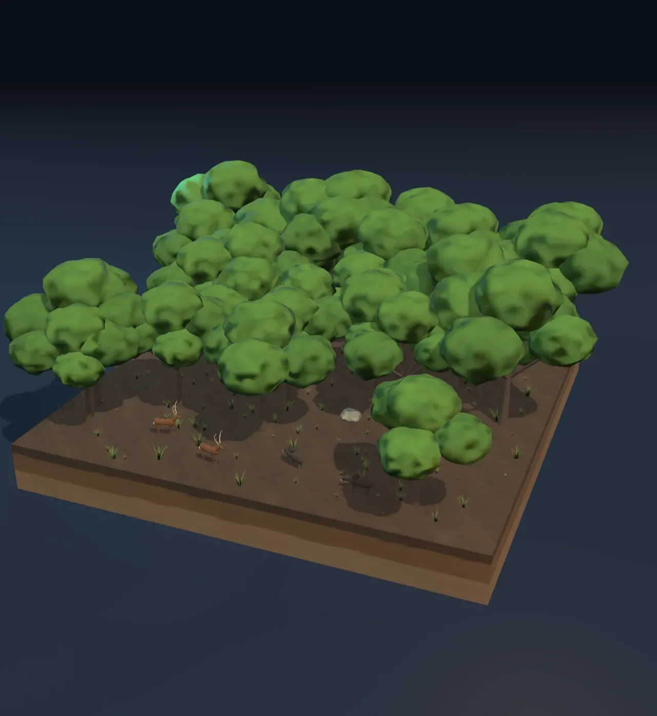
A region like that, recognised by the shape of its plants, is a biome. Biologists usually count around a dozen on land; the Scene shows seven of the biggest: tundra, taiga, temperate forest, grassland, desert, savanna and tropical rainforest. Biomes are named after their plants because plants cannot walk away from bad weather. They stay put and live with the climate, so they are its clearest record, and the animals depend on them for food and shelter.
A habitat is smaller and more particular: the place where one kind of organism lives and finds what it needs. A rotting log, a stream bank and the treetops are three habitats in the same forest. A woodpecker and a wood louse share a biome, not a habitat.
Try it: press Tropical, then slide Rainfall per year from 150 mm through 500 mm to 3,000 mm. Desert becomes savanna, then rainforest, at the same temperature.
Two numbers go a long way
In the 1970s the ecologist Robert Whittaker plotted the world’s biomes against just two numbers: a place’s mean annual temperature and its yearly rainfall. The biomes fell into neat regions. The chart beside the Scene is a diagram of that kind, drawn from this Scene’s own model, with your climate as the blue dot.
The shape of the diagram already tells a story. At the cold end, rain hardly matters: below a mean of about −9 °C the land is tundra whether it is dry or wet. At the warm end, rain sorts everything, from desert through savanna to rainforest. And the dry edge of the diagram is not flat: the warmer a place, the more rain it needs before a forest can grow. To see why, the rain has to be weighed against something.
Rain against thirst
Rain is only half of a place’s water budget. The other half is how much the air takes back. Warm air can hold far more water vapour than cold air, roughly twice as much for every 10 °C warmer, so in a hot place water evaporates from the soil and from leaves (through transpiration) far faster. Ecologists measure this thirst as the potential evapotranspiration: the water that wet ground covered in plants would give up in a year if it never ran short. The Scene uses a classic formula for it, worked out by the climatologist C. W. Thornthwaite in 1948, which needs only the monthly temperatures.
In the model, a place with a mean of −2 °C could lose about 320 mm a year; at 12 °C about 620 mm; at 26 °C nearly 1,500 mm. What matters to plants is the ratio of rain to that thirst:
When the ratio is below about 0.3, the air could take up more than three times the rain, and the land is desert. Plants there are spaced out, each claiming the water of a wide patch of ground; many store water, like the saguaro cactus, or shed their leaves and wait. Between about 0.3 and 0.85, there is enough water for grass but not for a closed forest: grassland in cooler places and savanna in the tropics, where the bar for a closed forest sits higher, at about 1.25, because the trees there grow all year. Above that, trees can keep their leaves watered and shade out the grass.
Try it: set Rainfall per year to 500 mm, then press Boreal, Temperate and Tropical in turn. The same rain gives a conifer forest, a grassland and a dry savanna, because the warmer the air, the more of the rain it takes back.
The bars under the chart show both sides of the budget: rain in blue and the air’s thirst in orange.
Warmth: the season trees need
The cold end of the diagram has a different limit. Trees need a growing season that is warm enough and long enough to build new wood and leaves. Measurements of treelines all over the world point to the same threshold: where the growing season averages less than about 6.4 °C, or lasts less than about three months, trees cannot grow. The model uses that rule. Beyond it lies the tundra: mosses, lichens, sedges and dwarf shrubs that hug the ground, where the air is a few degrees warmer and the winter snow covers them. Under the surface the soil stays frozen all year, the permafrost shown on the cut side of the tile.
Where summers are long enough for trees but short, conifers win. A spruce keeps its needles through the winter, so it can start making food the moment spring comes instead of spending weeks growing new leaves. The needles are narrow and waxy, which helps them survive frost and the dry months when the water in the ground is frozen, and the narrow cone of the tree sheds snow. The model calls a forest taiga when fewer than four months a year average above 10 °C. With longer summers, temperate forest takes over: broadleaf trees such as oak and beech, whose wide, thin leaves catch more light but are not worth keeping through a winter, so they drop them every autumn.
In the tropics there is no winter at all; the model calls a place tropical when even its coolest month stays above 16 °C. Plants can grow all year as long as there is water. Where rain is plentiful the tropical rainforest grows taller and denser than any other biome, with emergent trees above the canopy, palms and saplings below, and more kinds of plants and animals than anywhere else on land. Where the trees run short of water for part of the year, grass fills the gaps between them: the savanna, kept open by fire and by grazing and browsing animals.
Try it: set Rainfall per year to 1,000 mm and slide Mean temperature slowly from −15 to 30 °C. The tundra gives way to spruces, the spruces to broadleaf trees, and those, past 20 °C, to savanna: 1,000 mm a year is plenty for a forest in a cool place, but too little for a closed forest in the tropics, where the warm air takes most of it back. Slide the rain up to 3,000 mm and the rainforest appears.
Climbing a mountain
The air gets colder as you climb, by about 6.5 °C for every 1,000 m, because rising air expands and cools (layers of the atmosphere explains why). So a mountain is a short cut through the biomes. In 1802 the naturalist Alexander von Humboldt climbed most of the way up Chimborazo, in Ecuador, and mapped the plants in belts up its slopes, from tropical forest at the foot, through cooler forests and high grassland, to bare rock and snow. Climbing a few thousand metres in the tropics changes the climate about as much as travelling thousands of kilometres towards a pole.
Choose Mountain under Raise a mountain. The tile rises into a mountain 5,000 m high, and every spot on it grows what the climate at its own height allows. The rain stays the same; only the temperature falls. On the chart, the climb is a line running left from your dot, with a tick every 1,000 m.
The colder air higher up is also less thirsty. So a dry foothill can carry a forest further up, on the same rain. Mountains rising out of deserts, like the “sky islands” of Arizona, wear belts of oak and pine above their cactus-covered slopes for exactly this reason.
Try it: press Tropical and set Rainfall per year to 500 mm, then choose Mountain under Raise a mountain. The savanna at the foot gives way to grassland and then forest on the slopes, before the trees stop and the tundra and snow begin.
Two animals in each biome
Each biome in the Scene has two typical animals, each pair from one part of the world: caribou and Arctic fox on the tundra, moose and wolf in the taiga, red deer and wild boar in a European forest, bison and prairie dogs on the North American prairie, coyote and black-tailed jackrabbit in the deserts of the American Southwest, zebra and giraffe on the African savanna, and jaguar and toucan in the Amazon rainforest. Other continents have different animals in the same biome, often shaped alike by the same conditions: kangaroos graze Australia’s grasslands as bison grazed North America’s.
Their bodies fit their habitats. A caribou’s broad hooves spread its weight on soft tundra and snow; a jackrabbit’s long, thin ears give off heat in the desert; a giraffe reaches leaves in the savanna’s acacias that no other grazer can. The animals in turn shape the plants: grazers keep grasslands open, and the predators that eat them change where they graze. How those populations rise and fall together is the subject of ecosystems and population dynamics, and how a biome’s carbon and nitrogen go round is in cycles of matter.
Climate on the move
Because biomes follow climate, they move when the climate changes. During the last ice age, tundra covered much of Europe, and forests have since marched north behind the melting ice. Today, as the climate warms, treelines are creeping up mountains and northwards into the tundra, and the plants and animals that live on cold summits have nowhere higher to go.
What this model leaves out
The model’s year is a smooth swing of temperature, and the size of that swing is tied to the mean: the colder the place, the bigger the difference between summer and winter. Real places differ. The middle of Siberia has summers warm enough for forest even though its mean is about −9 °C, so the real taiga reaches colder means than the model allows. Rain in the model falls evenly through the year. In reality its timing matters as much as its amount: a place with dry summers and wet winters grows evergreen shrubland, and the length of the dry season, more than the yearly total, decides between savanna and rainforest.
Thornthwaite’s formula judges the air’s thirst from temperature alone. It leaves out sunshine, wind and how dry the air already is, so it underestimates the thirst of sunny, windy, dry places. The thresholds in the model are rounded numbers chosen to match the broad pattern of the world’s biomes, not measured boundaries. Real boundaries are gradual zones, and the Scene blends from one biome to the next even though its label changes at a single value.
Climate is not the only cause. Soils, fire, grazing animals and history shape every biome, and in many places people have replaced it with farms and towns: most of the world’s temperate grasslands are now farmland. On the mountain the rain stays the same all the way up, while real mountains catch more rain on the side facing the wind and leave a dry rain shadow on the other, as storms and weather and the water cycle explain.